
USCG Icebreaker Healy Captures Images of the Arctic for AI Analysis
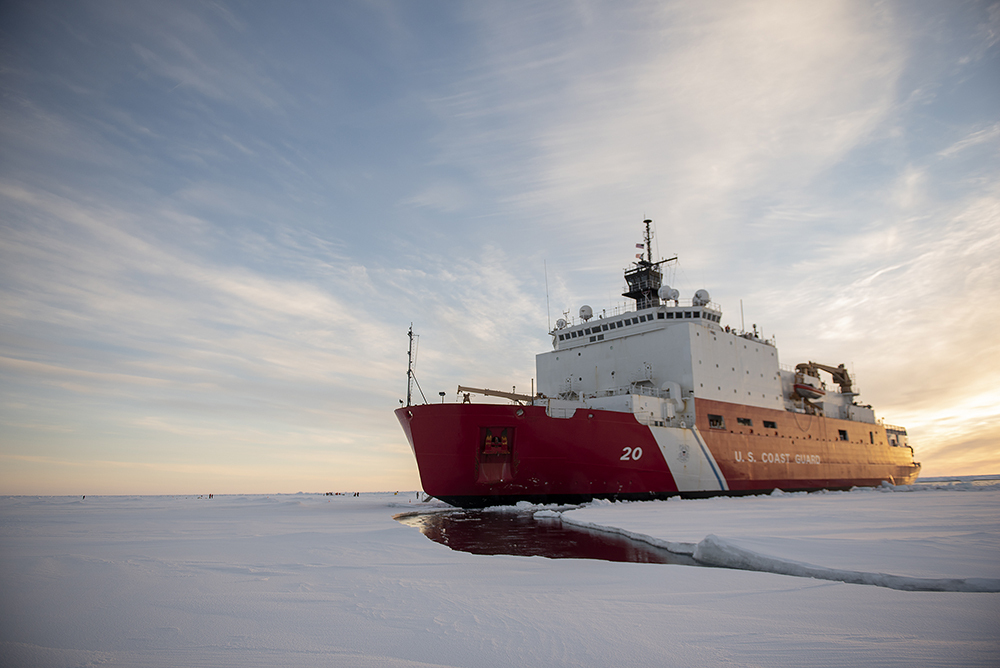
The U.S. Coast Guard (USCG) icebreaker Healy is on a historic voyage across the North Pole, capturing images of the rapidly changing Arctic. Equipped with a camera system developed by Lincoln Laboratory researchers, the Healy is generating a unique dataset that will be used to develop artificial intelligence (AI) tools for analyzing Arctic imagery.
Understanding the Significance
The Arctic region is experiencing significant changes due to global warming and melting sea ice. As Arctic passages open up to more traffic, including military vessels and illegal fishing ships, the United States faces national security challenges. Additionally, questions arise about the changing climate, wildlife, and geography of the Arctic.
However, there are very few imagery datasets available to study these changes. Satellites and aircraft can only provide limited information, while a ship-mounted camera system can capture more details and angles. By training AI computer-vision tools with these images, the U.S. Coast Guard can enhance navigation, automate analysis, and better plan naval missions in the Arctic.
The USCG icebreaker Healy is the largest and most technologically advanced in its fleet, making it an ideal candidate for this project. Developed in collaboration with the USCG Research and Development Center, the Cold Region Imaging and Surveillance Platform (CRISP) was installed on the Healy to capture infrared images of the Arctic surroundings.
Features of the CRISP System
The CRISP system includes a long-wave infrared camera designed for harsh maritime environments. Manufactured by Teledyne FLIR, the camera can operate in complete darkness, fog, and glare. It is also equipped with a GPS-enabled time-synchronized clock and a network video recorder to record both video and still imagery with positional data.
The camera is mounted on the ship’s fly bridge, with the electronics housed in a ruggedized rack on the bridge. It can be manually operated or placed into an autonomous surveillance mode, capturing video every three hours and a still image every 15 seconds. The resulting dataset is expected to be about 4 terabytes in size.
During the installation of the CRISP system, the laboratory team was faced with unexpected challenges. Working with the ship’s crew, they had to quickly adjust their route for running cables, but successfully installed the equipment on the Healy.
Release of the Dataset and Future Plans
Once the three-month USCG science mission concludes in the fall, the CRISP project team plans to publicly release the dataset. The goal is to enable the wider research community to develop better tools for navigation and analysis in the Arctic. Additionally, the laboratory team will provide a baseline object-detection model for others to build upon.
By applying AI to data from the Arctic, researchers can contribute to combatting climate change and further understanding this unique region. The AI Software Architectures and Algorithms Group at Lincoln Laboratory is proud to be part of this project and excited to see the advances that come from AI applications in the Arctic. The dataset will be available for free download on the Lincoln Laboratory website.